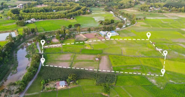
In the realm of rural property transactions, the significance of meticulous attention to detail cannot be overstated. One critical aspect that often warrants particular emphasis is the scrutiny of a land registry title plan used for transactions.
Already this year there was a report in my local paper of an unfortunate case where a couple bought a house and land in the New Forest, which they extended. Later to find that the part on which they have built the extension is not on land they own. It has actually been built on land that they only had a licence for. We all share in that sinking feeling when the reality of this situation hits home.
The planning authority is now considering whether to commence enforcement actions for the build or whether the homeowners can swap some of their paddock to be designated as National park. We await the outcome of the application. Whilst the swap would solve the issue and mean any land loss for grazing animals is recovered by the land swap it does set a precedent which the New Forest National park might not be keen to adopt.
Similarly, I am currently acting for a landowner whose neighbour has constructed a large barn which encroaches onto my client’s land. Once again, if plans had been properly reviewed before commencement of the development this would not have occurred.
Identifying ownership
How can this happen? As an experienced rural property lawyer, checking what your client will own at the end of the transaction is one of the first enquiries I make. Does the red edging of the agent’s plan reflect the land registry title plan? Not always the case. If you are about to become the freehold owners of a property, the land registry title plan is the first point of reference to check the plan actually includes all of the land you have agreed to buy. Quite often when dealing with agricultural land I might find that a corner of a field is missing off a title plan. Whilst the owner may have farmed the whole of the field for generations it may have simply been incorrectly mapped on a historical conveyance or plan.
Once a plan has been produced it will form part of the contract and be attached to the contract. It has to be signed by all parties to the transaction confirming they agree to the area being sold/purchased. Scrutiny of the plan at all levels is imperative.
In the first case I mention, a licence will not be registered on the Freehold title at the Land registry. But, the fact that the red edging on the title plan does not include all of the land being purchased should be a red flag in itself to a buyer. We can also carry out an index map search against a plan which will reveal those parts of the property which have a registered title number allocated to them and any parts that remain unregistered. We can delve deeper into an unregistered title to see who owns or occupies the land to satisfy our purchaser that that they will get good title to this parcel of land.
How Moore Barlow can help
One of the most compelling reasons for scrutinizing plans is to mitigate the risk of future disputes or legal challenges arising from boundary ambiguities or ownership disputes as in the circumstances above. By proactively addressing any discrepancies or ambiguities in these plans prior to exchanging contracts on a purchase, buyers can avoid costly and protracted legal battles down the line.
The Landed estates & farming team at Moore Barlow can conduct comprehensive plan reviews, provide legal advice to ensure smooth transactions and mitigate the risk of future disputes.